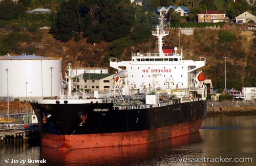
 TEMPEST DREAM
Current Status
Where is the vessel?
TEMPEST DREAM is currently in 43 nm NW of Erdemir, based on AIS data received about 17h ago.
Latest AIS update:
Current position: 41.95667° N, 31.06500° E (43 nm NW of Erdemir)
Average speed (last 7 days): Loading…
Average speed (last 30 days): Loading…
Vessel profile: TEMPEST DREAM is a Crude Oil Tanker with dimensions m x m.
This page combines live AIS, route history, probable destination signals, nearby traffic, and port activity for practical vessel monitoring.
The current position of vessel TEMPEST DREAM is 41.95667 lat / 31.06500 lng. Updated: 2026-05-21 03:10:18 UTCNearest reference points:
- Near Erdemir
- 45 nm N of RUMELI FENERI
- Near Derince
Currently sailing under the flag of Sierra Leone ![]()
Details:
Live Vessel TEMPEST DREAM Analytics (details, animations, etc.)
Recent AIS points (UTC):
2026-05-21 03:10:18 UTC · 41.95667, 31.06500 · SOG 12 kn · COG -1°2026-05-21 03:10:18 UTC · 41.95667, 31.06500 · SOG 12 kn · COG -1°
2026-05-21 03:10:18 UTC · 41.95667, 31.06500 · SOG 12 kn · COG -1°
2026-05-21 03:10:18 UTC · 41.95667, 31.06500 · SOG 12 kn · COG -1°