 GSL ELIZABETH
Current Status
Where is the vessel?
GSL ELIZABETH is currently in 14 nm S of Conakry Eco, based on AIS data received about 14h ago.
Latest AIS update:
Current position: 9.27391° N, 13.77457° W (14 nm S of Conakry Eco)
Average speed (last 7 days): Loading…
Average speed (last 30 days): Loading…
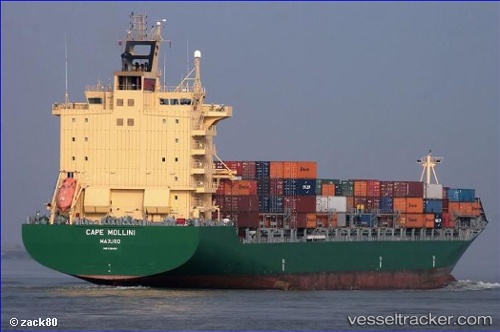
Vessel profile: GSL ELIZABETH is a Container Ship with dimensions 221m x 221m.
This page combines live AIS, route history, probable destination signals, nearby traffic, and port activity for practical vessel monitoring.
The current position of vessel GSL ELIZABETH is 9.27391 lat / -13.77457 lng. Updated: 2026-05-19 03:43:58 UTCNearest reference points:
- 28 nm S of Conakry
- Near Conakry
- Near NASSIT
Currently sailing under the flag of Liberia ![]()
GSL ELIZABETH built in 2006 year
Deadweight:
37883 tDetails:
Live Vessel GSL ELIZABETH Analytics (details, animations, etc.)
Recent AIS points (UTC):
2026-05-18 23:55:56 UTC · 9.27366, -13.77648 · SOG 0.1 kn · COG 17°2026-05-19 01:29:01 UTC · 9.27387, -13.77669 · SOG 0 kn · COG 24°
2026-05-19 01:29:01 UTC · 9.27387, -13.77669 · SOG 0 kn · COG 24°
2026-05-19 03:43:58 UTC · 9.27391, -13.77457 · SOG 0.2 kn · COG 324°