 vesseltracker.com
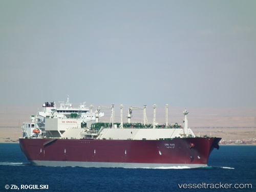
 Umm Bab
Current Status
Where is the vessel?
Umm Bab is currently in Near BUKOM ISLAND, based on AIS data received about 417d ago.
Latest AIS update:
Current position: 1.16850° N, 103.71223° E (Near BUKOM ISLAND)
Average speed (last 7 days): Loading…
Average speed (last 30 days): Loading…
Vessel profile: Umm Bab is a Lng Tanker with dimensions 285m x 44m.
This page combines live AIS, route history, probable destination signals, nearby traffic, and port activity for practical vessel monitoring.
The current position of vessel Umm Bab is 1.16850 lat / 103.71223 lng. Updated: 2025-03-27 03:59:59 UTCNearest reference points:
- Near BUKOM ISLAND
- Near JURONG ISLAND
- Near Pulau Ayer Chawan
Currently sailing under the flag of Greece ![]()
Umm Bab built in 2005 year
Deadweight:
84659 tDetails:
Live Vessel Umm Bab Analytics (details, animations, etc.)
Recent AIS points (UTC):
2025-03-27 03:59:59 UTC · 1.16850, 103.71223 · SOG 0 kn · COG 260°