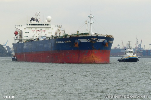
 BANGUS
Current Status
Where is the vessel?
BANGUS is currently in 86 nm S of Mul Dwårka, based on AIS data received about 18d ago.
Latest AIS update:
Current position: 19.38773° N, 70.17014° E (86 nm S of Mul Dwårka)
Average speed (last 7 days): Loading…
Average speed (last 30 days): Loading…
Vessel profile: BANGUS is a Oil Products Tanker with dimensions m x m.
This page combines live AIS, route history, probable destination signals, nearby traffic, and port activity for practical vessel monitoring.
The current position of vessel BANGUS is 19.38773 lat / 70.17014 lng. Updated: 2026-05-03 00:28:57 UTCNearest reference points:
- 33 nm S of Mul Dwårka
- Near Jafarabad
- 17 nm SE of Port Pipavav
Currently sailing under the flag of Panama ![]()
Details:
Live Vessel BANGUS Analytics (details, animations, etc.)
Recent AIS points (UTC):
2026-05-03 00:28:57 UTC · 19.38773, 70.17014 · SOG 9.4 kn · COG 149°