 Senryumaru
Current Status
Where is the vessel?
Senryumaru is currently in Near ONOMICHIITOZAKI, based on AIS data received about 15h ago.
Latest AIS update:
Current position: 34.39618° N, 133.18166° E (Near ONOMICHIITOZAKI)
Average speed (last 7 days): Loading…
Average speed (last 30 days): Loading…
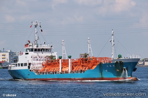
Vessel profile: Senryumaru is a Lpg Tanker with dimensions 62m x 11m.
This page combines live AIS, route history, probable destination signals, nearby traffic, and port activity for practical vessel monitoring.
The current position of vessel Senryumaru is 34.39618 lat / 133.18166 lng. Updated: 2026-05-20 17:04:49 UTCNearest reference points:
- Near ONOMICHIITOZAKI
- Near HAKATASHIMA
- Near FUKUYAMA
Currently sailing under the flag of Japan ![]()
Details:
Live Vessel Senryumaru Analytics (details, animations, etc.)
Recent AIS points (UTC):
2026-05-20 13:25:43 UTC · 34.39615, 133.18159 · SOG 0 kn · COG 5°2026-05-20 14:04:44 UTC · 34.39612, 133.18159 · SOG 0 kn · COG 6°
2026-05-20 15:49:47 UTC · 34.39613, 133.18164 · SOG 0 kn · COG 5°
2026-05-20 17:04:49 UTC · 34.39618, 133.18166 · SOG 0 kn · COG 5°