 Panasiatic
Current Status
Where is the vessel?
Panasiatic is currently in 119 nm NW of Kulhudhuffushi, based on AIS data received about 15h ago.
Latest AIS update:
Current position: 8.11333° N, 71.72833° E (119 nm NW of Kulhudhuffushi)
Average speed (last 7 days): Loading…
Average speed (last 30 days): Loading…
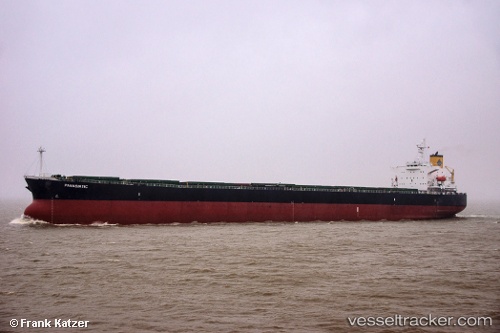
Vessel profile: Panasiatic is a Bulk Carrier with dimensions 229m x 32m.
This page combines live AIS, route history, probable destination signals, nearby traffic, and port activity for practical vessel monitoring.
The current position of vessel Panasiatic is 8.11333 lat / 71.72833 lng. Updated: 2026-06-13 12:06:20 UTCNearest reference points:
- 119 nm SE of Tinaquillo
- 130 nm W of Lakshadweep
- 45 nm SW of Kalpeni Island
Currently sailing under the flag of Marshall Is ![]()
Panasiatic built in 2005 year
Deadweight:
82962 tDetails:
Live Vessel Panasiatic Analytics (details, animations, etc.)
Recent AIS points (UTC):
2026-06-13 07:45:18 UTC · 8.46167, 70.97167 · SOG 11 kn · COG -1°2026-06-13 10:06:20 UTC · 8.28167, 71.37667 · SOG 11 kn · COG -1°
2026-06-13 11:12:20 UTC · 8.18833, 71.56833 · SOG 11 kn · COG -1°
2026-06-13 12:06:20 UTC · 8.11333, 71.72833 · SOG 11 kn · COG -1°