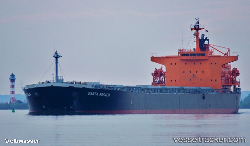
Santa Rosalia
Current StatusWhere is the vessel?
Santa Rosalia is currently in 26 nm NE of Moa, based on AIS data received about 14h ago.
Latest AIS update:
Current position: 20.87445° N, 74.49972° W (26 nm NE of Moa)
Average speed (last 7 days): Loading…
Average speed (last 30 days): Loading…
Vessel profile: Santa Rosalia is a Bulk Carrier with dimensions 32m x 225m.
This page combines live AIS, route history, probable destination signals, nearby traffic, and port activity for practical vessel monitoring.
The current position of vessel Santa Rosalia is 20.87445 lat / -74.49972 lng. Updated: 2026-05-20 04:38:58 UTCNearest reference points:
- 47 nm SW of Cockburn Harbour
- 56 nm SW of Cockburn Harbour
Details:
Live Vessel Santa Rosalia Analytics (details, animations, etc.)
Recent AIS points (UTC):
2026-05-20 01:06:10 UTC · 21.03066, -75.17627 · SOG 11 kn · COG 102°2026-05-20 02:20:40 UTC · 20.97740, -74.93545 · SOG 11.2 kn · COG 104°
2026-05-20 03:02:30 UTC · 20.94805, -74.80145 · SOG 10.8 kn · COG 104°
2026-05-20 04:38:58 UTC · 20.87445, -74.49972 · SOG 10.9 kn · COG 102°