 vesseltracker.com
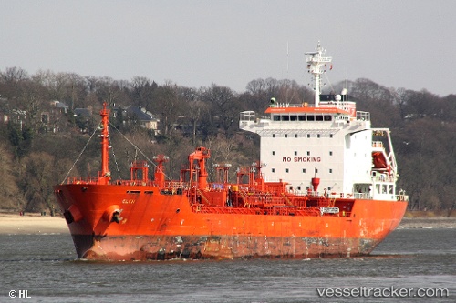
 K INSET
Current Status
Where is the vessel?
K INSET is currently in 12 nm N of Dellys, based on AIS data received less than 1h ago.
Latest AIS update:
Current position: 37.10525° N, 3.81643° E (12 nm N of Dellys)
Average speed (last 7 days): Loading…
Average speed (last 30 days): Loading…
Vessel profile: K INSET is a Chemical/Oil Products Tanker with dimensions 127m x 20m.
This page combines live AIS, route history, probable destination signals, nearby traffic, and port activity for practical vessel monitoring.
The current position of vessel K INSET is 37.10525 lat / 3.81643 lng. Updated: 2026-05-14 17:23:57 UTCNearest reference points:
- Near Zamoranos
- Near Algiers
- 16 nm NE of Berja
Currently sailing under the flag of Liberia ![]()
K INSET built in 2005 year
Deadweight:
12956 tDetails:
Live Vessel K INSET Analytics (details, animations, etc.)
Recent AIS points (UTC):
2026-05-14 14:04:58 UTC · 37.13375, 4.39482 · SOG 9.4 kn · COG 265°2026-05-14 16:11:16 UTC · 37.13098, 3.99587 · SOG 9.6 kn · COG 261°
2026-05-14 16:19:30 UTC · 37.14517, 3.98375 · SOG 10.3 kn · COG 350°
2026-05-14 17:23:57 UTC · 37.10525, 3.81643 · SOG 9.2 kn · COG 264°