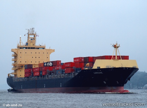
 Lorraine
Current Status
Where is the vessel?
Lorraine is currently in 208 nm SW of Sde Uziyahu, based on AIS data received about 14h ago.
Latest AIS update:
Current position: 29.47714° N, 37.71615° W (208 nm SW of Sde Uziyahu)
Average speed (last 7 days): Loading…
Average speed (last 30 days): Loading…
Vessel profile: Lorraine is a Container Ship with dimensions 221m x 221m.
This page combines live AIS, route history, probable destination signals, nearby traffic, and port activity for practical vessel monitoring.
The current position of vessel Lorraine is 29.47714 lat / -37.71615 lng. Updated: 2026-05-25 01:31:01 UTCNearest reference points:
- 197 nm W of Kafr Kanna
Currently sailing under the flag of Liberia ![]()
Lorraine built in 2006 year
Deadweight:
37800 tDetails:
Live Vessel Lorraine Analytics (details, animations, etc.)
Recent AIS points (UTC):
2026-05-24 21:49:09 UTC · 29.15849, -38.62774 · SOG 14.1 kn · COG 69°2026-05-24 21:49:09 UTC · 29.15849, -38.62774 · SOG 14.1 kn · COG 69°
2026-05-24 23:22:53 UTC · 29.29554, -38.24149 · SOG 13.9 kn · COG 70°
2026-05-25 01:31:01 UTC · 29.47714, -37.71615 · SOG 14 kn · COG 68°