 Aller
Aller
Current Status
Where is the vessel?
Aller is currently in Near Saint-Christol, based on AIS data received about 14h ago.
Latest AIS update:
Current position: 43.61799° N, 4.79290° W (Near Saint-Christol)
Average speed (last 7 days): Loading…
Average speed (last 30 days): Loading…
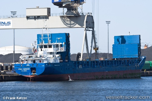
Vessel profile: Aller is a Multi Purpose Carrier with dimensions 89m x 13m.
This page combines live AIS, route history, probable destination signals, nearby traffic, and port activity for practical vessel monitoring.
The current position of vessel Aller is 43.61799 lat / -4.79290 lng. Updated: 2026-06-16 13:52:06 UTCNearest reference points:
- Near Mazcuerras
- Near Tremanes
- Near Musel-Arnao
Currently sailing under the flag of Antigua Barbuda ![]()
Aller built in 2005 year
Deadweight:
2910 tDetails:
Live Vessel Aller Analytics (details, animations, etc.)
Recent AIS points (UTC):
2026-06-16 10:08:58 UTC · 43.62034, -4.14445 · SOG 7.5 kn · COG 273°2026-06-16 11:38:58 UTC · 43.60960, -4.40291 · SOG 7.3 kn · COG 263°
2026-06-16 13:45:47 UTC · 43.61627, -4.77387 · SOG 7.9 kn · COG 276°
2026-06-16 13:52:06 UTC · 43.61799, -4.79290 · SOG 7.8 kn · COG 276°