 KVITSAND
Current Status
Where is the vessel?
KVITSAND is currently in Near Terdonk, based on AIS data received about 15h ago.
Latest AIS update:
Current position: 51.14413° N, 3.79459° E (Near Terdonk)
Average speed (last 7 days): Loading…
Average speed (last 30 days): Loading…
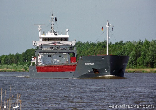
Vessel profile: KVITSAND is a General Cargo Ship with dimensions 111m x 14m.
This page combines live AIS, route history, probable destination signals, nearby traffic, and port activity for practical vessel monitoring.
The current position of vessel KVITSAND is 51.14413 lat / 3.79459 lng. Updated: 2026-06-15 01:34:21 UTCNearest reference points:
- Near Rieme
- Near Oostakker
- Near SLUISKIL
Currently sailing under the flag of Norway (NIS) ![]()
KVITSAND built in 2005 year
Deadweight:
6665 tDetails:
Live Vessel KVITSAND Analytics (details, animations, etc.)
Recent AIS points (UTC):
2026-06-14 22:49:24 UTC · 51.19382, 3.80179 · SOG 8.6 kn · COG 177°2026-06-14 23:34:10 UTC · 51.14411, 3.79473 · SOG 0 kn · COG 104°
2026-06-15 01:19:28 UTC · 51.14415, 3.79462 · SOG 0 kn · COG -1°
2026-06-15 01:34:21 UTC · 51.14413, 3.79459 · SOG 0 kn · COG 105°