 vesseltracker.com
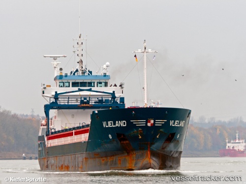
 Vlieland
Current Status
Where is the vessel?
Vlieland is currently in 24 nm SE of Krieschow, based on AIS data received less than 1h ago.
Latest AIS update:
Current position: 51.46622° N, 2.27237° E (24 nm SE of Krieschow)
Average speed (last 7 days): Loading…
Average speed (last 30 days): Loading…
Vessel profile: Vlieland is a Multi Purpose Carrier with dimensions 111m x 14m.
This page combines live AIS, route history, probable destination signals, nearby traffic, and port activity for practical vessel monitoring.
The current position of vessel Vlieland is 51.46622 lat / 2.27237 lng. Updated: 2026-05-15 17:52:37 UTCNearest reference points:
- 13 nm NW of Middelkerke
- Near Dunkerque
- 15 nm E of RAMSGATE
Currently sailing under the flag of Netherlands ![]()
Vlieland built in 2005 year
Deadweight:
6000 tDetails:
Live Vessel Vlieland Analytics (details, animations, etc.)
Recent AIS points (UTC):
2026-05-15 13:29:37 UTC · 50.96869, 1.59090 · SOG 10.6 kn · COG 42°2026-05-15 15:33:08 UTC · 51.19622, 1.97711 · SOG 9.2 kn · COG 51°
2026-05-15 16:38:58 UTC · 51.32144, 2.14010 · SOG 8.8 kn · COG 33°
2026-05-15 17:52:37 UTC · 51.46622, 2.27237 · SOG 7.9 kn · COG 33°