 PINE GAS
Current Status
Where is the vessel?
PINE GAS is currently in Open sea (no nearby ports in database), based on AIS data received about 14h ago.
Latest AIS update:
Current position: 11.57062° S, 62.88281° E (Open sea (no nearby ports in database))
Average speed (last 7 days): Loading…
Average speed (last 30 days): Loading…
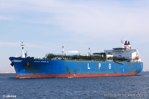
Vessel profile: PINE GAS is a LPG Tanker with dimensions 36m x 225m.
This page combines live AIS, route history, probable destination signals, nearby traffic, and port activity for practical vessel monitoring.
The current position of vessel PINE GAS is -11.57062 lat / 62.88281 lng. Updated: 2026-05-19 16:11:21 UTCNearest reference points:
- Open sea (no nearby ports in database)
Currently sailing under the flag of India ![]()
PINE GAS built in 2006 year
Deadweight:
58585 tDetails:
Live Vessel PINE GAS Analytics (details, animations, etc.)
Recent AIS points (UTC):
2026-05-19 13:10:20 UTC · -11.08769, 63.39254 · SOG 13.7 kn · COG 223°2026-05-19 13:10:20 UTC · -11.08769, 63.39254 · SOG 13.7 kn · COG 223°
2026-05-19 16:11:21 UTC · -11.57062, 62.88281 · SOG 13.8 kn · COG 227°
2026-05-19 16:11:21 UTC · -11.57062, 62.88281 · SOG 13.8 kn · COG 227°