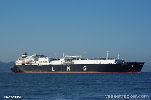
 OB RIVER
Current Status
Where is the vessel?
OB RIVER is currently in 128 nm W of Sebang, based on AIS data received about 14h ago.
Latest AIS update:
Current position: 6.33500° N, 93.20500° E (128 nm W of Sebang)
Average speed (last 7 days): Loading…
Average speed (last 30 days): Loading…
Vessel profile: OB RIVER is a LNG Tanker with dimensions 288m x 44m.
This page combines live AIS, route history, probable destination signals, nearby traffic, and port activity for practical vessel monitoring.
The current position of vessel OB RIVER is 6.33500 lat / 93.20500 lng. Updated: 2026-07-03 19:57:13 UTCNearest reference points:
- 160 nm W of Sebang
- 80 nm W of Sebang
- 172 nm W of LHOKNGA
Currently sailing under the flag of Marshall Islands ![]()
OB RIVER built in 2007 year
Deadweight:
84682 tDetails:
Live Vessel OB RIVER Analytics (details, animations, etc.)
Recent AIS points (UTC):
2026-07-03 16:51:12 UTC · 6.30333, 92.56833 · SOG 12 kn · COG -1°2026-07-03 17:45:12 UTC · 6.30167, 92.75500 · SOG 12 kn · COG -1°
2026-07-03 18:48:13 UTC · 6.32333, 92.96667 · SOG 12 kn · COG -1°
2026-07-03 19:57:13 UTC · 6.33500, 93.20500 · SOG 12 kn · COG -1°