 vesseltracker.com
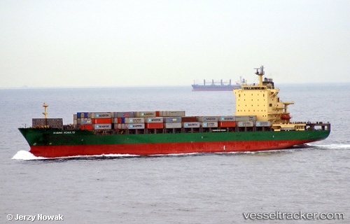
 MSC VAIGA III
Current Status
Where is the vessel?
MSC VAIGA III is currently in Near Kalianak Barat, based on AIS data received less than 1h ago.
Latest AIS update:
Current position: 7.19575° S, 112.70219° E (Near Kalianak Barat)
Average speed (last 7 days): Loading…
Average speed (last 30 days): Loading…
Vessel profile: MSC VAIGA III is a Container Ship with dimensions 30m x 215m.
This page combines live AIS, route history, probable destination signals, nearby traffic, and port activity for practical vessel monitoring.
The current position of vessel MSC VAIGA III is -7.19575 lat / 112.70219 lng. Updated: 2026-05-14 07:53:16 UTCNearest reference points:
- Near Kalianak Barat
- Near Tanjung Perak
- Near Gresik, Java
Currently sailing under the flag of Liberia ![]()
MSC VAIGA III built in 2005 year
Deadweight:
39275 tDetails:
Live Vessel MSC VAIGA III Analytics (details, animations, etc.)
Recent AIS points (UTC):
2026-05-14 04:52:01 UTC · -7.19576, 112.70217 · SOG 0 kn · COG 101°2026-05-14 05:39:41 UTC · -7.19574, 112.70219 · SOG 0 kn · COG 101°
2026-05-14 07:47:14 UTC · -7.19574, 112.70219 · SOG 0 kn · COG 100°
2026-05-14 07:53:16 UTC · -7.19575, 112.70219 · SOG 0 kn · COG 100°