 vesseltracker.com
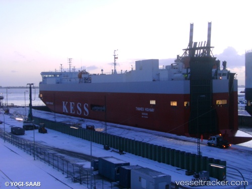
 Thames Highway
Current Status
Where is the vessel?
Thames Highway is currently in 33 nm S of Framwellgate, based on AIS data received less than 1h ago.
Latest AIS update:
Current position: 54.23477° N, 1.73230° E (33 nm S of Framwellgate)
Average speed (last 7 days): Loading…
Average speed (last 30 days): Loading…
Vessel profile: Thames Highway is a Vehicles Carrier with dimensions 148m x 25m.
This page combines live AIS, route history, probable destination signals, nearby traffic, and port activity for practical vessel monitoring.
The current position of vessel Thames Highway is 54.23477 lat / 1.73230 lng. Updated: 2026-04-26 13:01:53 UTCNearest reference points:
- 48 nm NE of Somersby
- 14 nm E of Withernsea
- Near Withernsea
Currently sailing under the flag of Bahamas ![]()
Thames Highway built in 2005 year
Deadweight:
7750 tDetails:
Live Vessel Thames Highway Analytics (details, animations, etc.)
Recent AIS points (UTC):
2026-04-26 09:52:09 UTC · 54.61915, 0.14154 · SOG 18.9 kn · COG 116°2026-04-26 10:34:45 UTC · 54.52701, 0.49405 · SOG 19.2 kn · COG 111°
2026-04-26 11:57:58 UTC · 54.36077, 1.19460 · SOG 19.2 kn · COG 112°
2026-04-26 13:01:53 UTC · 54.23477, 1.73230 · SOG 19.1 kn · COG 109°