 Hai Duong 36
Current Status
Where is the vessel?
Hai Duong 36 is currently in Near VISAKHAPATNAM, based on AIS data received about 14h ago.
Latest AIS update:
Current position: 17.65877° N, 83.35390° E (Near VISAKHAPATNAM)
Average speed (last 7 days): Loading…
Average speed (last 30 days): Loading…
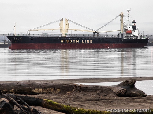
Vessel profile: Hai Duong 36 is a General Cargo Ship with dimensions 121m x 18m.
This page combines live AIS, route history, probable destination signals, nearby traffic, and port activity for practical vessel monitoring.
The current position of vessel Hai Duong 36 is 17.65877 lat / 83.35390 lng. Updated: 2026-05-19 04:16:39 UTCNearest reference points:
- Near Vishakhapatnam
- Near Wipro Sez/Resapuvanipalem
- Near Gopalpur
Currently sailing under the flag of Panama ![]()
Hai Duong 36 built in 2005 year
Deadweight:
10650 tDetails:
Live Vessel Hai Duong 36 Analytics (details, animations, etc.)
Recent AIS points (UTC):
2026-05-18 23:15:26 UTC · 17.69504, 83.28029 · SOG 0 kn · COG -1°2026-05-19 01:21:26 UTC · 17.69505, 83.28026 · SOG 0 kn · COG -1°
2026-05-19 02:21:26 UTC · 17.69508, 83.28029 · SOG 0 kn · COG -1°
2026-05-19 04:16:39 UTC · 17.65877, 83.35390 · SOG 9.4 kn · COG -1°