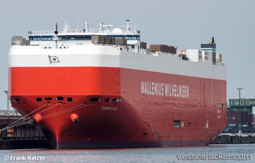
 Tortugas
Current Status
Where is the vessel?
Tortugas is currently in Open sea, approx. 476 nm off the nearest listed port, based on AIS data received about 14h ago.
Latest AIS update:
Current position: 17.42921° S, 75.68225° E (Open sea, approx. 476 nm off the nearest listed port)
Average speed (last 7 days): Loading…
Average speed (last 30 days): Loading…
Vessel profile: Tortugas is a Vehicles Carrier with dimensions 199m x 199m.
This page combines live AIS, route history, probable destination signals, nearby traffic, and port activity for practical vessel monitoring.
The current position of vessel Tortugas is -17.42921 lat / 75.68225 lng. Updated: 2026-05-20 17:57:17 UTCNearest reference points:
- Open sea, approx. 476 nm off the nearest listed port
- Open sea, approx. 478 nm off the nearest listed port
- Open sea, approx. 480 nm off the nearest listed port
Currently sailing under the flag of Malta ![]()
Tortugas built in 2006 year
Deadweight:
14512 tDetails:
Live Vessel Tortugas Analytics (details, animations, etc.)
Recent AIS points (UTC):
2026-05-20 13:33:19 UTC · -17.01242, 76.84391 · SOG 16.3 kn · COG 247°2026-05-20 15:34:40 UTC · -17.21892, 76.31431 · SOG 16.2 kn · COG 250°
2026-05-20 16:42:25 UTC · -17.32024, 76.01501 · SOG 16.5 kn · COG 253°
2026-05-20 17:57:17 UTC · -17.42921, 75.68225 · SOG 16.3 kn · COG 249°