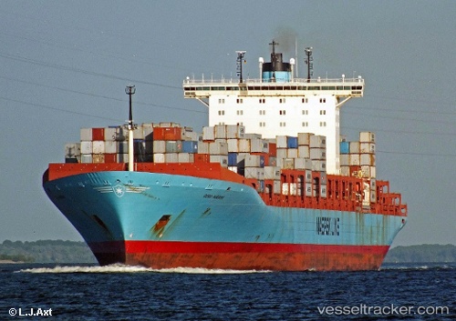
 Gerd Maersk
Current Status
Where is the vessel?
Gerd Maersk is currently in Near YANGSHAN, based on AIS data received about 14h ago.
Latest AIS update:
Current position: 30.61529° N, 122.07110° E (Near YANGSHAN)
Average speed (last 7 days): Loading…
Average speed (last 30 days): Loading…
Vessel profile: Gerd Maersk is a Container Ship with dimensions 367m x 42m.
This page combines live AIS, route history, probable destination signals, nearby traffic, and port activity for practical vessel monitoring.
The current position of vessel Gerd Maersk is 30.61529 lat / 122.07110 lng. Updated: 2026-05-20 22:54:06 UTCNearest reference points:
- Near YANGSHAN
- 12 nm W of YANGSHAN
- 10 nm N of YANGSHAN
Currently sailing under the flag of Denmark ![]()
Gerd Maersk built in 2006 year
Deadweight:
115700 tDetails:
Live Vessel Gerd Maersk Analytics (details, animations, etc.)
Recent AIS points (UTC):
2026-05-20 18:18:07 UTC · 30.61530, 122.07109 · SOG 0 kn · COG 306°2026-05-20 19:03:05 UTC · 30.61530, 122.07109 · SOG 0 kn · COG 306°
2026-05-20 21:30:11 UTC · 30.61530, 122.07109 · SOG 0 kn · COG 306°
2026-05-20 22:54:06 UTC · 30.61529, 122.07110 · SOG 0 kn · COG 306°