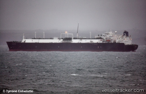
Golar Maria
Current StatusWhere is the vessel?
Golar Maria is currently in Near Puerta de Tierra, based on AIS data received about 14h ago.
Latest AIS update:
Current position: 18.42978° N, 66.10435° W (Near Puerta de Tierra)
Average speed (last 7 days): Loading…
Average speed (last 30 days): Loading…
Vessel profile: Golar Maria is a Lng Tanker with dimensions 43m x 285m.
This page combines live AIS, route history, probable destination signals, nearby traffic, and port activity for practical vessel monitoring.
The current position of vessel Golar Maria is 18.42978 lat / -66.10435 lng. Updated: 2026-05-20 13:35:49 UTCNearest reference points:
- Near San Juan
- Near Roosevelt Roads
- Near Isabel Segunda
Details:
Live Vessel Golar Maria Analytics (details, animations, etc.)
Recent AIS points (UTC):
2026-05-20 10:35:47 UTC · 18.42977, -66.10436 · SOG 0 kn · COG 238°2026-05-20 12:23:47 UTC · 18.42978, -66.10434 · SOG 0 kn · COG 238°
2026-05-20 13:17:56 UTC · 18.42979, -66.10434 · SOG 0 kn · COG 238°
2026-05-20 13:35:49 UTC · 18.42978, -66.10435 · SOG 0 kn · COG 238°