 NICOBAR
Current Status
Where is the vessel?
NICOBAR is currently in Near East Providence, based on AIS data received about 14h ago.
Latest AIS update:
Current position: 41.78987° N, 71.38069° W (Near East Providence)
Average speed (last 7 days): Loading…
Average speed (last 30 days): Loading…
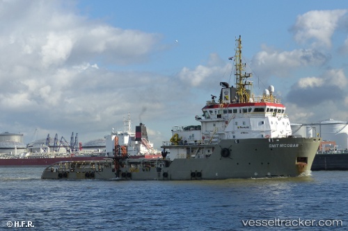
Vessel profile: NICOBAR is a Offshore Tug/Supply Ship with dimensions 16m x 71m.
This page combines live AIS, route history, probable destination signals, nearby traffic, and port activity for practical vessel monitoring.
The current position of vessel NICOBAR is 41.78987 lat / -71.38069 lng. Updated: 2026-05-20 16:20:52 UTCNearest reference points:
- Near East Providence
- Near DAVISVILLE
- Near MELVILLE
Currently sailing under the flag of Belgium ![]()
NICOBAR built in 2006 year
Deadweight:
1930 tDetails:
Live Vessel NICOBAR Analytics (details, animations, etc.)
Recent AIS points (UTC):
2026-05-20 12:20:46 UTC · 41.78990, -71.38074 · SOG 0 kn · COG 149°2026-05-20 13:29:47 UTC · 41.78993, -71.38073 · SOG 0 kn · COG 149°
2026-05-20 13:59:46 UTC · 41.78982, -71.38067 · SOG 0 kn · COG 149°
2026-05-20 16:20:52 UTC · 41.78987, -71.38069 · SOG 0 kn · COG 149°