See Thunder
Current StatusWhere is the vessel?
See Thunder is currently in 10 nm S of Wadi Feiran, based on AIS data received about 21h ago.
Latest AIS update:
Current position: 28.56890° N, 33.20192° E (10 nm S of Wadi Feiran)
Average speed (last 7 days): Loading…
Average speed (last 30 days): Loading…
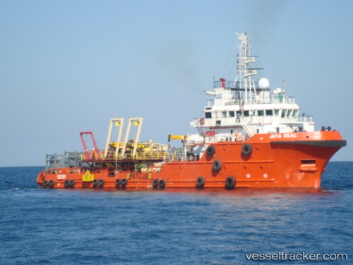
Vessel profile: See Thunder is a Offshore Tug Supply Ship with dimensions 15m x 62m.
This page combines live AIS, route history, probable destination signals, nearby traffic, and port activity for practical vessel monitoring.
The current position of vessel See Thunder is 28.56890 lat / 33.20192 lng. Updated: 2026-05-20 15:14:51 UTCNearest reference points:
- Near Ras Gharib
- 19 nm SE of Zeit Bay
- Near El-Guna (El Gouna)
Details:
Live Vessel See Thunder Analytics (details, animations, etc.)
Recent AIS points (UTC):
2026-05-20 15:14:51 UTC · 28.56890, 33.20192 · SOG 0.4 kn · COG 313°2026-05-20 15:14:51 UTC · 28.56890, 33.20192 · SOG 0.4 kn · COG 313°
2026-05-20 15:14:51 UTC · 28.56890, 33.20192 · SOG 0.4 kn · COG 313°
2026-05-20 15:14:51 UTC · 28.56890, 33.20192 · SOG 0.4 kn · COG 313°