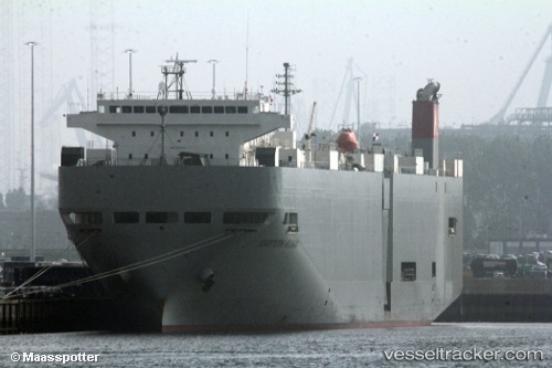
Eastern Highway
Current StatusWhere is the vessel?
Eastern Highway is currently in Near Fremantle, based on AIS data received about 15h ago.
Latest AIS update:
Current position: 32.02007° S, 115.67456° E (Near Fremantle)
Average speed (last 7 days): Loading…
Average speed (last 30 days): Loading…
Vessel profile: Eastern Highway is a Vehicles Carrier with dimensions 28m x 188m.
This page combines live AIS, route history, probable destination signals, nearby traffic, and port activity for practical vessel monitoring.
The current position of vessel Eastern Highway is -32.02007 lat / 115.67456 lng. Updated: 2026-05-20 07:54:40 UTCNearest reference points:
- Near ROTTNEST ISLAND
- Near Fremantle
- Near Kwinana
Details:
Live Vessel Eastern Highway Analytics (details, animations, etc.)
Recent AIS points (UTC):
2026-05-20 04:54:40 UTC · -32.02028, 115.67450 · SOG 0.1 kn · COG 336°2026-05-20 06:18:40 UTC · -32.02013, 115.67469 · SOG 0.1 kn · COG 348°
2026-05-20 07:30:40 UTC · -32.02000, 115.67463 · SOG 0.1 kn · COG 310°
2026-05-20 07:54:40 UTC · -32.02007, 115.67456 · SOG 0.2 kn · COG 295°