 Penelop
Current Status
Where is the vessel?
Penelop is currently in 40 nm N of Los Ramos, based on AIS data received about 14h ago.
Latest AIS update:
Current position: 38.65236° N, 10.34440° W (40 nm N of Los Ramos)
Average speed (last 7 days): Loading…
Average speed (last 30 days): Loading…
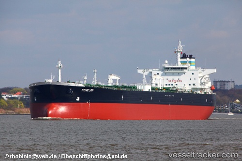
Vessel profile: Penelop is a Crude Oil Tanker with dimensions 255m x 44m.
This page combines live AIS, route history, probable destination signals, nearby traffic, and port activity for practical vessel monitoring.
The current position of vessel Penelop is 38.65236 lat / -10.34440 lng. Updated: 2026-05-22 05:49:04 UTCNearest reference points:
- 18 nm W of Colares
- Near CASCAIS
- Near PENICHE
Currently sailing under the flag of Bahamas ![]()
Penelop built in 2006 year
Deadweight:
115091 tDetails:
Live Vessel Penelop Analytics (details, animations, etc.)
Recent AIS points (UTC):
2026-05-22 02:34:54 UTC · 39.24677, -10.39067 · SOG 11.6 kn · COG 177°2026-05-22 04:00:34 UTC · 38.97716, -10.37158 · SOG 10.8 kn · COG 179°
2026-05-22 04:27:14 UTC · 38.89508, -10.36763 · SOG 10.9 kn · COG 179°
2026-05-22 05:49:04 UTC · 38.65236, -10.34440 · SOG 10.6 kn · COG 167°