 vesseltracker.com
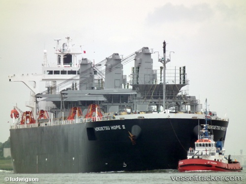
Hokuetsu Hope 2
Current StatusWhere is the vessel?
Hokuetsu Hope 2 is currently in 84 nm NE of Yangkou Pt, based on AIS data received about 14h ago.
Latest AIS update:
Current position: 33.42927° N, 122.70532° E (84 nm NE of Yangkou Pt)
Average speed (last 7 days): Loading…
Average speed (last 30 days): Loading…
Vessel profile: Hokuetsu Hope 2 is a Wood Chips Carrier with dimensions 32m x 210m.
This page combines live AIS, route history, probable destination signals, nearby traffic, and port activity for practical vessel monitoring.
The current position of vessel Hokuetsu Hope 2 is 33.42927 lat / 122.70532 lng. Updated: 2026-05-17 22:39:24 UTCNearest reference points:
- 79 nm NE of Yangkou Pt
- 99 nm NE of Yangkou Pt
- 108 nm W of Gageohyangri
Details:
Live Vessel Hokuetsu Hope 2 Analytics (details, animations, etc.)
Recent AIS points (UTC):
2026-05-17 19:50:46 UTC · 33.95008, 122.52640 · SOG 10 kn · COG 170°2026-05-17 20:10:29 UTC · 33.89500, 122.54500 · SOG 10 kn · COG -1°
2026-05-17 21:16:23 UTC · 33.69871, 122.61192 · SOG 11.5 kn · COG 167°
2026-05-17 22:39:24 UTC · 33.42927, 122.70532 · SOG 12 kn · COG 161°