 BALLATA
Current Status
Where is the vessel?
BALLATA is currently in Near LANGEDRAG, based on AIS data received about 15h ago.
Latest AIS update:
Current position: 57.68930° N, 11.84564° E (Near LANGEDRAG)
Average speed (last 7 days): Loading…
Average speed (last 30 days): Loading…
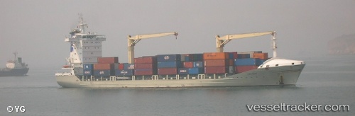
Vessel profile: BALLATA is a General Cargo with dimensions m x m.
This page combines live AIS, route history, probable destination signals, nearby traffic, and port activity for practical vessel monitoring.
The current position of vessel BALLATA is 57.68930 lat / 11.84564 lng. Updated: 2026-05-20 04:42:18 UTCNearest reference points:
- Near LANGEDRAG
- Near WEST FROLUNDA
- Near Goteborg
Currently sailing under the flag of Lithuania ![]()
Details:
Live Vessel BALLATA Analytics (details, animations, etc.)
Recent AIS points (UTC):
2026-05-20 01:04:53 UTC · 57.56591, 11.66042 · SOG 0 kn · COG 109°2026-05-20 02:04:50 UTC · 57.56628, 11.66076 · SOG 0 kn · COG 129°
2026-05-20 04:09:04 UTC · 57.68941, 11.84579 · SOG 0 kn · COG 8°
2026-05-20 04:42:18 UTC · 57.68930, 11.84564 · SOG 0 kn · COG 7°