 vesseltracker.com
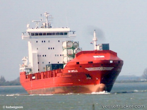
 ALOPO
ALOPO
Current Status
Where is the vessel?
ALOPO is currently in 15 nm N of Dellys, based on AIS data received about 2h ago.
Latest AIS update:
Current position: 37.17124° N, 3.83489° E (15 nm N of Dellys)
Average speed (last 7 days): Loading…
Average speed (last 30 days): Loading…
Vessel profile: ALOPO is a Container Ship with dimensions 20m x 129m.
This page combines live AIS, route history, probable destination signals, nearby traffic, and port activity for practical vessel monitoring.
The current position of vessel ALOPO is 37.17124 lat / 3.83489 lng. Updated: 2026-05-13 17:18:33 UTCNearest reference points:
- Near Zamoranos
- Near Algiers
- 16 nm NE of Berja
Currently sailing under the flag of Liberia ![]()
ALOPO built in 2004 year
Deadweight:
8261 tDetails:
Live Vessel ALOPO Analytics (details, animations, etc.)
Recent AIS points (UTC):
2026-05-13 14:22:55 UTC · 36.75977, 3.08929 · SOG 10.5 kn · COG 83°2026-05-13 15:33:36 UTC · 36.99167, 3.29833 · SOG 15 kn · COG -1°
2026-05-13 16:33:34 UTC · 37.09333, 3.60333 · SOG 16 kn · COG -1°
2026-05-13 17:18:33 UTC · 37.17124, 3.83489 · SOG 16.3 kn · COG 75°