 LUANDA EXPRESS
Current Status
Where is the vessel?
LUANDA EXPRESS is currently in Near Luanda, based on AIS data received about 14h ago.
Latest AIS update:
Current position: 8.74145° S, 13.23539° E (Near Luanda)
Average speed (last 7 days): Loading…
Average speed (last 30 days): Loading…
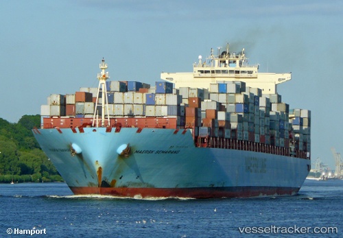
Vessel profile: LUANDA EXPRESS is a Container Ship with dimensions 332m x 332m.
This page combines live AIS, route history, probable destination signals, nearby traffic, and port activity for practical vessel monitoring.
The current position of vessel LUANDA EXPRESS is -8.74145 lat / 13.23539 lng. Updated: 2026-06-23 00:06:02 UTCNearest reference points:
- Near Luanda
- Near Greater Plutonio
Currently sailing under the flag of Liberia ![]()
LUANDA EXPRESS built in 2007 year
Deadweight:
108447 tDetails:
Live Vessel LUANDA EXPRESS Analytics (details, animations, etc.)
Recent AIS points (UTC):
2026-06-22 19:21:26 UTC · -8.74167, 13.23500 · SOG 0 kn · COG -1°2026-06-22 21:21:06 UTC · -8.74155, 13.23581 · SOG 0 kn · COG 228°
2026-06-22 22:27:04 UTC · -8.74135, 13.23538 · SOG 0.1 kn · COG 217°
2026-06-23 00:06:02 UTC · -8.74145, 13.23539 · SOG 0.1 kn · COG 211°