 vesseltracker.com
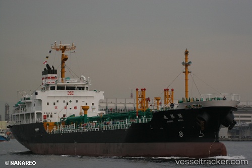
 Shoho Maru
Current Status
Where is the vessel?
Shoho Maru is currently in Near TADOTSU, based on AIS data received about 1h ago.
Latest AIS update:
Current position: 34.32330° N, 133.64922° E (Near TADOTSU)
Average speed (last 7 days): Loading…
Average speed (last 30 days): Loading…
Vessel profile: Shoho Maru is a Chemical Oil Products Tanker with dimensions 105m x 105m.
This page combines live AIS, route history, probable destination signals, nearby traffic, and port activity for practical vessel monitoring.
The current position of vessel Shoho Maru is 34.32330 lat / 133.64922 lng. Updated: 2026-04-15 03:36:27 UTCNearest reference points:
- Near FUKUYAMA
- Near MIZUSHIMA
- Near Sakaide
Currently sailing under the flag of Japan ![]()
Shoho Maru built in 2004 year
Deadweight:
4999 tDetails:
Live Vessel Shoho Maru Analytics (details, animations, etc.)
Recent AIS points (UTC):
2026-04-14 20:11:57 UTC · 34.62550, 135.13589 · SOG 0 kn · COG 61°2026-04-14 22:08:57 UTC · 34.60473, 135.08919 · SOG 12.5 kn · COG 254°
2026-04-14 23:48:55 UTC · 34.49668, 134.60480 · SOG 14.4 kn · COG 247°
2026-04-15 03:36:27 UTC · 34.32330, 133.64922 · SOG 13.6 kn · COG 243°