 CAP LARA
Current Status
Where is the vessel?
CAP LARA is currently in 81 nm SW of Bentota River Apt, based on AIS data received about 14h ago.
Latest AIS update:
Current position: 5.65333° N, 78.86666° E (81 nm SW of Bentota River Apt)
Average speed (last 7 days): Loading…
Average speed (last 30 days): Loading…
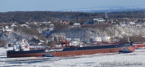
Vessel profile: CAP LARA is a Crude Oil Tanker with dimensions 46m x 274m.
This page combines live AIS, route history, probable destination signals, nearby traffic, and port activity for practical vessel monitoring.
The current position of vessel CAP LARA is 5.65333 lat / 78.86666 lng. Updated: 2026-05-19 03:32:44 UTCNearest reference points:
- 67 nm SW of Moratuwa
- 82 nm W of Moratuwa
- 38 nm SW of Galle
Currently sailing under the flag of Liberia ![]()
CAP LARA built in 2007 year
Deadweight:
158826 tDetails:
Live Vessel CAP LARA Analytics (details, animations, etc.)
Recent AIS points (UTC):
2026-05-18 23:40:20 UTC · 5.44500, 79.66167 · SOG 12 kn · COG -1°2026-05-19 01:29:06 UTC · 5.48500, 79.27667 · SOG 12 kn · COG -1°
2026-05-19 01:29:06 UTC · 5.48500, 79.27667 · SOG 12 kn · COG -1°
2026-05-19 03:32:44 UTC · 5.65333, 78.86666 · SOG 13 kn · COG -1°