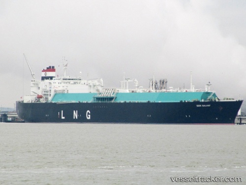
Seri Balhaf
Current StatusWhere is the vessel?
Seri Balhaf is currently in Near SUNGAI UDANG, based on AIS data received about 14h ago.
Latest AIS update:
Current position: 2.21981° N, 102.07446° E (Near SUNGAI UDANG)
Average speed (last 7 days): Loading…
Average speed (last 30 days): Loading…
Vessel profile: Seri Balhaf is a Lng Tanker with dimensions 46m x 295m.
This page combines live AIS, route history, probable destination signals, nearby traffic, and port activity for practical vessel monitoring.
The current position of vessel Seri Balhaf is 2.21981 lat / 102.07446 lng. Updated: 2026-05-22 07:41:04 UTCNearest reference points:
- Near SUNGAI UDANG
- Near Malacca
- Near MELAKA
Details:
Live Vessel Seri Balhaf Analytics (details, animations, etc.)
Recent AIS points (UTC):
2026-05-22 04:17:03 UTC · 2.21822, 102.07437 · SOG 0 kn · COG 300°2026-05-22 04:20:03 UTC · 2.21823, 102.07437 · SOG 0 kn · COG 300°
2026-05-22 05:26:04 UTC · 2.21834, 102.07441 · SOG 0 kn · COG 294°
2026-05-22 07:41:04 UTC · 2.21981, 102.07446 · SOG 0.2 kn · COG 252°