 VALENCIA ELIZABETH D
Current Status
Where is the vessel?
VALENCIA ELIZABETH D is currently in Near Termini Imerese, based on AIS data received about 14h ago.
Latest AIS update:
Current position: 37.98872° N, 13.70410° E (Near Termini Imerese)
Average speed (last 7 days): Loading…
Average speed (last 30 days): Loading…
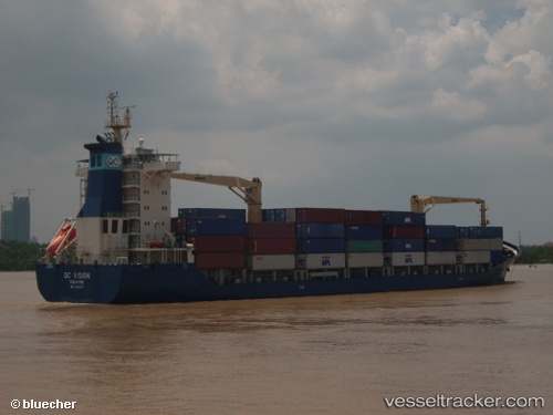
Vessel profile: VALENCIA ELIZABETH D is a Container Ship with dimensions 148m x 23m.
This page combines live AIS, route history, probable destination signals, nearby traffic, and port activity for practical vessel monitoring.
The current position of vessel VALENCIA ELIZABETH D is 37.98872 lat / 13.70410 lng. Updated: 2026-05-20 09:39:33 UTCNearest reference points:
- Near Palermo
- Near Balestrate
- Near Licata
Currently sailing under the flag of Liberia ![]()
VALENCIA ELIZABETH D built in 2006 year
Deadweight:
13797 tDetails:
Live Vessel VALENCIA ELIZABETH D Analytics (details, animations, etc.)
Recent AIS points (UTC):
2026-05-20 06:00:09 UTC · 37.98875, 13.70408 · SOG 0.1 kn · COG 170°2026-05-20 07:42:19 UTC · 37.98874, 13.70407 · SOG 0 kn · COG 169°
2026-05-20 08:06:22 UTC · 37.98874, 13.70410 · SOG 0 kn · COG 170°
2026-05-20 09:39:33 UTC · 37.98872, 13.70410 · SOG 0 kn · COG 170°