 TRISTAR RUBY
Current Status
Where is the vessel?
TRISTAR RUBY is currently in 86 nm NE of Syowa, based on AIS data received about 661d ago.
Latest AIS update:
Current position: 67.88374° S, 42.04765° E (86 nm NE of Syowa)
Average speed (last 7 days): Loading…
Average speed (last 30 days): Loading…
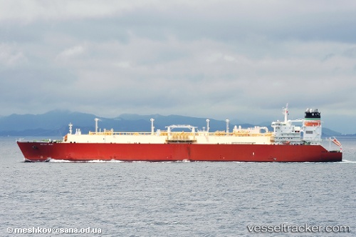
Vessel profile: TRISTAR RUBY is a LNG Tanker with dimensions 44m x 288m.
This page combines live AIS, route history, probable destination signals, nearby traffic, and port activity for practical vessel monitoring.
The current position of vessel TRISTAR RUBY is -67.88374 lat / 42.04765 lng. Updated: 2024-07-28 06:04:54 UTCCurrently sailing under the flag of Liberia ![]()
TRISTAR RUBY built in 2008 year
Deadweight:
84491 tDetails:
Live Vessel TRISTAR RUBY Analytics (details, animations, etc.)
Recent AIS points (UTC):
2024-07-28 06:04:54 UTC · -67.88374, 42.04765 · SOG 5.5 kn · COG 72°