 KMARIN DIAMOND
Current Status
Where is the vessel?
KMARIN DIAMOND is currently in 89 nm NE of Tambanum, based on AIS data received about 16h ago.
Latest AIS update:
Current position: 3.26593° S, 144.74701° E (89 nm NE of Tambanum)
Average speed (last 7 days): Loading…
Average speed (last 30 days): Loading…
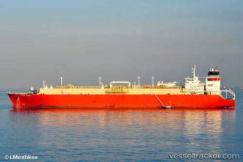
Vessel profile: KMARIN DIAMOND is a Lng Tanker with dimensions m x m.
This page combines live AIS, route history, probable destination signals, nearby traffic, and port activity for practical vessel monitoring.
The current position of vessel KMARIN DIAMOND is -3.26593 lat / 144.74701 lng. Updated: 2026-06-13 07:30:15 UTCCurrently sailing under the flag of Liberia ![]()
Details:
Live Vessel KMARIN DIAMOND Analytics (details, animations, etc.)
Recent AIS points (UTC):
2026-06-13 04:18:07 UTC · -2.94626, 144.23029 · SOG 11.6 kn · COG 119°2026-06-13 06:16:49 UTC · -3.14167, 144.55167 · SOG 10 kn · COG -1°
2026-06-13 07:01:52 UTC · -3.21166, 144.67000 · SOG 11 kn · COG -1°
2026-06-13 07:30:15 UTC · -3.26593, 144.74701 · SOG 11.6 kn · COG 116°