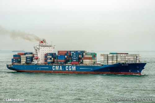
 Anl Wyong
Current Status
Where is the vessel?
Anl Wyong is currently in Near Dakar, based on AIS data received about 14h ago.
Latest AIS update:
Current position: 14.60900° N, 17.36660° W (Near Dakar)
Average speed (last 7 days): Loading…
Average speed (last 30 days): Loading…
Vessel profile: Anl Wyong is a Container Ship with dimensions 260m x 32m.
This page combines live AIS, route history, probable destination signals, nearby traffic, and port activity for practical vessel monitoring.
The current position of vessel Anl Wyong is 14.609 lat / -17.3666 lng. Updated: 2026-06-16 16:20:27 UTCNearest reference points:
- Near Rufisque
- Near Dakar
- Near Banjul
Currently sailing under the flag of Malta ![]()
Anl Wyong built in 2008 year
Deadweight:
52000 tDetails:
Live Vessel Anl Wyong Analytics (details, animations, etc.)
Recent AIS points (UTC):
2026-06-16 13:44:54 UTC · 14.60970, -17.36680 · SOG 0.1 kn · COG -1°2026-06-16 13:50:32 UTC · 14.60970, -17.36680 · SOG 0.2 kn · COG 245°
2026-06-16 16:11:28 UTC · 14.60920, -17.36670 · SOG 0 kn · COG 261°
2026-06-16 16:20:27 UTC · 14.60900, -17.36660 · SOG 0.1 kn · COG 267°