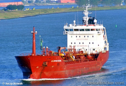
 NORTHSEA RATIONAL
Current Status
Where is the vessel?
NORTHSEA RATIONAL is currently in 11 nm N of Abbot Point, based on AIS data received about 16h ago.
Latest AIS update:
Current position: 19.72220° S, 148.14146° E (11 nm N of Abbot Point)
Average speed (last 7 days): Loading…
Average speed (last 30 days): Loading…
Vessel profile: NORTHSEA RATIONAL is a Oil/Chemical Tanker with dimensions m x m.
This page combines live AIS, route history, probable destination signals, nearby traffic, and port activity for practical vessel monitoring.
The current position of vessel NORTHSEA RATIONAL is -19.72220 lat / 148.14146 lng. Updated: 2026-05-20 17:55:57 UTCNearest reference points:
- Near AIRLIE
- Near Abell Point
- Near Whitsunday Island
Currently sailing under the flag of Malta ![]()
Details:
Live Vessel NORTHSEA RATIONAL Analytics (details, animations, etc.)
Recent AIS points (UTC):
2026-05-20 14:01:58 UTC · -19.72218, 148.14153 · SOG 0 kn · COG 150°2026-05-20 15:28:19 UTC · -19.72216, 148.14156 · SOG 0 kn · COG 148°
2026-05-20 16:08:59 UTC · -19.72202, 148.14165 · SOG 0 kn · COG 156°
2026-05-20 17:55:57 UTC · -19.72220, 148.14146 · SOG 0.3 kn · COG 129°