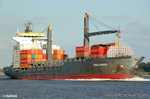
 Hansa Marburg
Current Status
Where is the vessel?
Hansa Marburg is currently in Near Damietta, based on AIS data received about 15h ago.
Latest AIS update:
Current position: 31.62049° N, 31.83831° E (Near Damietta)
Average speed (last 7 days): Loading…
Average speed (last 30 days): Loading…
Vessel profile: Hansa Marburg is a Container Ship with dimensions 175m x 28m.
This page combines live AIS, route history, probable destination signals, nearby traffic, and port activity for practical vessel monitoring.
The current position of vessel Hansa Marburg is 31.62049 lat / 31.83831 lng. Updated: 2026-05-20 19:32:03 UTCNearest reference points:
- Near Damietta
- 21 nm N of Port Said
- 15 nm N of Port Said
Currently sailing under the flag of Liberia ![]()
Hansa Marburg built in 2007 year
Deadweight:
23419 tDetails:
Live Vessel Hansa Marburg Analytics (details, animations, etc.)
Recent AIS points (UTC):
2026-05-20 15:54:01 UTC · 31.71304, 31.91333 · SOG 8.9 kn · COG 241°2026-05-20 16:10:12 UTC · 31.68824, 31.87205 · SOG 9.9 kn · COG 242°
2026-05-20 18:03:33 UTC · 31.59555, 31.81257 · SOG 1.4 kn · COG 211°
2026-05-20 19:32:03 UTC · 31.62049, 31.83831 · SOG 1.3 kn · COG 30°