 vesseltracker.com
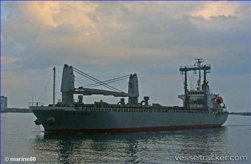
 ADNAN N
Current Status
Where is the vessel?
ADNAN N is currently in Near Dombraina Boiotias, based on AIS data received about 4h ago.
Latest AIS update:
Current position: 38.21727° N, 22.94445° E (Near Dombraina Boiotias)
Average speed (last 7 days): Loading…
Average speed (last 30 days): Loading…
Vessel profile: ADNAN N is a General Cargo Ship with dimensions 20m x 116m.
This page combines live AIS, route history, probable destination signals, nearby traffic, and port activity for practical vessel monitoring.
The current position of vessel ADNAN N is 38.21727 lat / 22.94445 lng. Updated: 2026-04-06 18:32:09 UTCNearest reference points:
- Near AGIOI THEODORI
- Near Náfplion
- Near AEGINA BOATYARD
Currently sailing under the flag of Barbados ![]()
ADNAN N built in 2006 year
Deadweight:
11776 tDetails:
Live Vessel ADNAN N Analytics (details, animations, etc.)
Recent AIS points (UTC):
2026-04-06 15:12:14 UTC · 38.21720, 22.94452 · SOG 0.1 kn · COG 91°2026-04-06 15:12:14 UTC · 38.21720, 22.94452 · SOG 0.1 kn · COG 91°
2026-04-06 18:32:09 UTC · 38.21727, 22.94445 · SOG 0 kn · COG 91°
2026-04-06 18:32:09 UTC · 38.21727, 22.94445 · SOG 0 kn · COG 91°