 MRC BELIZ
Current Status
Where is the vessel?
MRC BELIZ is currently in Near ESCOMBRERAS, based on AIS data received about 14h ago.
Latest AIS update:
Current position: 37.56826° N, 0.96561° W (Near ESCOMBRERAS)
Average speed (last 7 days): Loading…
Average speed (last 30 days): Loading…
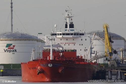
Vessel profile: MRC BELIZ is a Chemical/Oil Products Tanker with dimensions 32m x 183m.
This page combines live AIS, route history, probable destination signals, nearby traffic, and port activity for practical vessel monitoring.
The current position of vessel MRC BELIZ is 37.56826 lat / -0.96561 lng. Updated: 2026-07-16 16:13:54 UTCNearest reference points:
- Near ESCOMBRERAS
- Near Cartagena
- Near Mazarrón
Currently sailing under the flag of Malta ![]()
MRC BELIZ built in 2007 year
Deadweight:
46012 tDetails:
Live Vessel MRC BELIZ Analytics (details, animations, etc.)
Recent AIS points (UTC):
2026-07-16 13:47:52 UTC · 37.56825, -0.96562 · SOG 0 kn · COG -1°2026-07-16 13:57:59 UTC · 37.56828, -0.96563 · SOG 0 kn · COG 140°
2026-07-16 15:25:00 UTC · 37.56827, -0.96560 · SOG 0 kn · COG 140°
2026-07-16 16:13:54 UTC · 37.56826, -0.96561 · SOG 0 kn · COG -1°