 vesseltracker.com
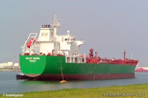
 Gulf Moon
Current Status
Where is the vessel?
Gulf Moon is currently in Near Evyap, based on AIS data received less than 1h ago.
Latest AIS update:
Current position: 40.76028° N, 29.66423° E (Near Evyap)
Average speed (last 7 days): Loading…
Average speed (last 30 days): Loading…
Vessel profile: Gulf Moon is a Chemical Oil Products Tanker with dimensions 184m x 184m.
This page combines live AIS, route history, probable destination signals, nearby traffic, and port activity for practical vessel monitoring.
The current position of vessel Gulf Moon is 40.76028 lat / 29.66423 lng. Updated: 2026-05-15 22:08:53 UTCNearest reference points:
- Near YARIMCA
- Near Diliskelesi
- Near Yilport
Currently sailing under the flag of Bahamas ![]()
Gulf Moon built in 2007 year
Deadweight:
37488 tDetails:
Live Vessel Gulf Moon Analytics (details, animations, etc.)
Recent AIS points (UTC):
2026-05-15 19:20:54 UTC · 40.76492, 29.66367 · SOG 0.3 kn · COG 359°2026-05-15 19:26:53 UTC · 40.76060, 29.66272 · SOG 0.2 kn · COG 2°
2026-05-15 21:50:53 UTC · 40.76215, 29.66058 · SOG 0.1 kn · COG 86°
2026-05-15 22:08:53 UTC · 40.76028, 29.66423 · SOG 0.1 kn · COG 70°