 vesseltracker.com
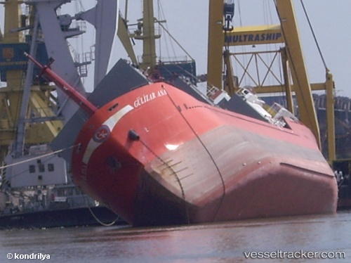
 Gulizar Ana
Current Status
Where is the vessel?
Gulizar Ana is currently in Near TOROS, based on AIS data received about 13h ago.
Latest AIS update:
Current position: 36.88107° N, 36.01062° E (Near TOROS)
Average speed (last 7 days): Loading…
Average speed (last 30 days): Loading…
Vessel profile: Gulizar Ana is a General Cargo Ship with dimensions 81m x 12m.
This page combines live AIS, route history, probable destination signals, nearby traffic, and port activity for practical vessel monitoring.
The current position of vessel Gulizar Ana is 36.88107 lat / 36.01062 lng. Updated: 2026-05-13 06:23:21 UTCNearest reference points:
- Near CEYHAN
- Near DORTYOL
- Near YUMURTALIC
Currently sailing under the flag of Turkey ![]()
Gulizar Ana built in 2005 year
Deadweight:
3300 tDetails:
Live Vessel Gulizar Ana Analytics (details, animations, etc.)
Recent AIS points (UTC):
2026-05-13 06:23:21 UTC · 36.88107, 36.01062 · SOG 0.8 kn · COG -1°2026-05-13 06:23:21 UTC · 36.88107, 36.01062 · SOG 0.8 kn · COG -1°
2026-05-13 06:23:21 UTC · 36.88107, 36.01062 · SOG 0.8 kn · COG -1°
2026-05-13 06:23:21 UTC · 36.88107, 36.01062 · SOG 0.8 kn · COG -1°