 Ym Utility
Current Status
Where is the vessel?
Ym Utility is currently in 28 nm SW of Satsumae, based on AIS data received about 14h ago.
Latest AIS update:
Current position: 41.07848° N, 139.68279° E (28 nm SW of Satsumae)
Average speed (last 7 days): Loading…
Average speed (last 30 days): Loading…
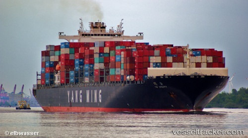
Vessel profile: Ym Utility is a Container Ship with dimensions 333m x 42m.
This page combines live AIS, route history, probable destination signals, nearby traffic, and port activity for practical vessel monitoring.
The current position of vessel Ym Utility is 41.07848 lat / 139.68279 lng. Updated: 2026-05-20 19:07:06 UTCNearest reference points:
- 11 nm NW of Yokohama, Aomori
- Near Yokohama, Aomori
- 23 nm NE of SAI
Currently sailing under the flag of Liberia ![]()
Ym Utility built in 2009 year
Deadweight:
103614 tDetails:
Live Vessel Ym Utility Analytics (details, animations, etc.)
Recent AIS points (UTC):
2026-05-20 15:45:35 UTC · 40.65937, 138.71330 · SOG 15.2 kn · COG 61°2026-05-20 17:02:06 UTC · 40.81709, 139.08263 · SOG 15 kn · COG 62°
2026-05-20 18:22:00 UTC · 40.98213, 139.46658 · SOG 14.9 kn · COG 62°
2026-05-20 19:07:06 UTC · 41.07848, 139.68279 · SOG 14.9 kn · COG 63°