 Haroy
Haroy
Current Status
Where is the vessel?
Haroy is currently in Near Levanger, based on AIS data received about 14h ago.
Latest AIS update:
Current position: 63.74958° N, 11.29875° E (Near Levanger)
Average speed (last 7 days): Loading…
Average speed (last 30 days): Loading…
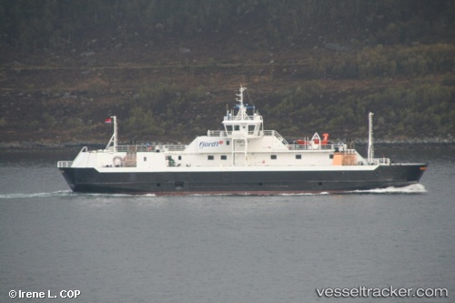
Vessel profile: Haroy is a Passenger Ro Ro Cargo Ship with dimensions 68m x 14m.
This page combines live AIS, route history, probable destination signals, nearby traffic, and port activity for practical vessel monitoring.
The current position of vessel Haroy is 63.74958 lat / 11.29875 lng. Updated: 2026-05-20 13:26:16 UTCNearest reference points:
- Near Leksvik
- Near Hommelvik
- Near Utvorda
Currently sailing under the flag of Norway ![]()
Haroy built in 2006 year
Deadweight:
500 tDetails:
Live Vessel Haroy Analytics (details, animations, etc.)
Recent AIS points (UTC):
2026-05-20 09:39:17 UTC · 63.77090, 11.26840 · SOG 10.4 kn · COG 115°2026-05-20 10:29:28 UTC · 63.79793, 11.16798 · SOG 0.1 kn · COG 19°
2026-05-20 11:49:47 UTC · 63.74956, 11.29878 · SOG 0 kn · COG 312°
2026-05-20 13:26:16 UTC · 63.74958, 11.29875 · SOG 0 kn · COG 312°