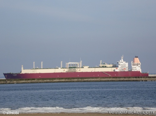
Al Ghariya
Current StatusWhere is the vessel?
Al Ghariya is currently in 299 nm SE of Ile Desroches, based on AIS data received about 14h ago.
Latest AIS update:
Current position: 9.58500° S, 56.80500° E (299 nm SE of Ile Desroches)
Average speed (last 7 days): Loading…
Average speed (last 30 days): Loading…
Vessel profile: Al Ghariya is a Lng Tanker with dimensions 50m x 315m.
This page combines live AIS, route history, probable destination signals, nearby traffic, and port activity for practical vessel monitoring.
The current position of vessel Al Ghariya is -9.58500 lat / 56.80500 lng. Updated: 2026-05-20 06:11:30 UTCNearest reference points:
- 217 nm SE of Ile Desroches
- Open sea, approx. 400 nm off the nearest listed port
- Open sea, approx. 403 nm off the nearest listed port
Details:
Live Vessel Al Ghariya Analytics (details, animations, etc.)
Recent AIS points (UTC):
2026-05-20 01:35:38 UTC · -9.57700, 56.85740 · SOG 0.1 kn · COG 267°2026-05-20 03:41:07 UTC · -9.57068, 56.83394 · SOG 0.3 kn · COG 281°
2026-05-20 04:01:56 UTC · -9.56917, 56.83129 · SOG 1 kn · COG 287°
2026-05-20 06:11:30 UTC · -9.58500, 56.80500 · SOG 1 kn · COG -1°