 vesseltracker.com
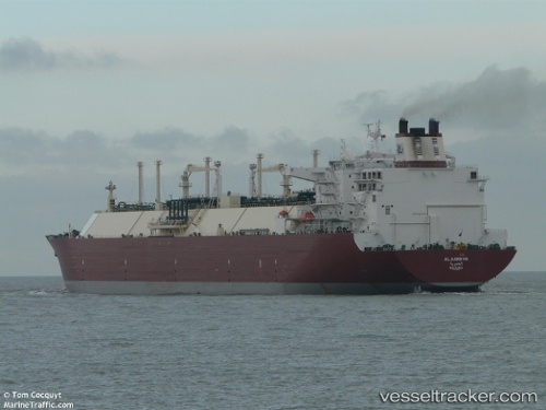
 Al Aamriya
Current Status
Where is the vessel?
Al Aamriya is currently in 285 nm SW of Okha, based on AIS data received about 15h ago.
Latest AIS update:
Current position: 19.17625° N, 65.44025° E (285 nm SW of Okha)
Average speed (last 7 days): Loading…
Average speed (last 30 days): Loading…
Vessel profile: Al Aamriya is a Lng Tanker with dimensions 316m x 50m.
This page combines live AIS, route history, probable destination signals, nearby traffic, and port activity for practical vessel monitoring.
The current position of vessel Al Aamriya is 19.17625 lat / 65.44025 lng. Updated: 2026-05-18 11:31:44 UTCNearest reference points:
- 231 nm SW of Keti Bandar
- 262 nm SE of SUR
- Open sea, approx. 402 nm off the nearest listed port
Currently sailing under the flag of Marshall Is ![]()
Al Aamriya built in 2007 year
Deadweight:
121935 tDetails:
Live Vessel Al Aamriya Analytics (details, animations, etc.)
Recent AIS points (UTC):
2026-05-18 08:04:01 UTC · 19.16705, 65.41455 · SOG 0.3 kn · COG 164°2026-05-18 09:21:04 UTC · 19.16760, 65.42689 · SOG 0.2 kn · COG 167°
2026-05-18 10:01:45 UTC · 19.16848, 65.43124 · SOG 0.5 kn · COG 153°
2026-05-18 11:31:44 UTC · 19.17625, 65.44025 · SOG 0.6 kn · COG 160°