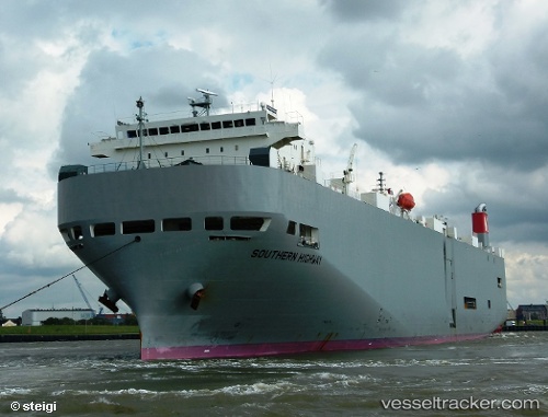
Southern Highway
Current StatusWhere is the vessel?
Southern Highway is currently in 11 nm SE of Byron Bay, based on AIS data received about 15h ago.
Latest AIS update:
Current position: 28.77709° S, 153.76408° E (11 nm SE of Byron Bay)
Average speed (last 7 days): Loading…
Average speed (last 30 days): Loading…
Vessel profile: Southern Highway is a Vehicles Carrier with dimensions 28m x 188m.
This page combines live AIS, route history, probable destination signals, nearby traffic, and port activity for practical vessel monitoring.
The current position of vessel Southern Highway is -28.77709 lat / 153.76408 lng. Updated: 2026-05-19 19:44:39 UTCNearest reference points:
- Near Gold Coast
- Near Labrador
- Near Biggera Waters
Details:
Live Vessel Southern Highway Analytics (details, animations, etc.)
Recent AIS points (UTC):
2026-05-19 16:26:57 UTC · -27.82647, 153.72470 · SOG 18.1 kn · COG 181°2026-05-19 18:27:56 UTC · -28.41282, 153.74731 · SOG 16.7 kn · COG 179°
2026-05-19 19:22:26 UTC · -28.67026, 153.76031 · SOG 17.1 kn · COG 179°
2026-05-19 19:44:39 UTC · -28.77709, 153.76408 · SOG 17.5 kn · COG 179°