 SIDRA AL RUWAIS
Current Status
Where is the vessel?
SIDRA AL RUWAIS is currently in 14 nm SE of RAS LAFFAN, based on AIS data received about 17h ago.
Latest AIS update:
Current position: 25.74049° N, 51.80570° E (14 nm SE of RAS LAFFAN)
Average speed (last 7 days): Loading…
Average speed (last 30 days): Loading…
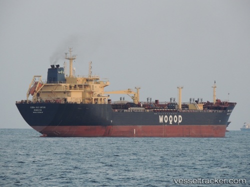
Vessel profile: SIDRA AL RUWAIS is a Oil/Chemical Tanker with dimensions m x m.
This page combines live AIS, route history, probable destination signals, nearby traffic, and port activity for practical vessel monitoring.
The current position of vessel SIDRA AL RUWAIS is 25.74049 lat / 51.80570 lng. Updated: 2026-05-22 01:57:55 UTCNearest reference points:
- Near RAS LAFFAN
- 21 nm NE of Halul Island
- Near KHALIFA BIN SALMAN
Currently sailing under the flag of Qatar ![]()
Details:
Live Vessel SIDRA AL RUWAIS Analytics (details, animations, etc.)
Recent AIS points (UTC):
2026-05-22 01:57:55 UTC · 25.74049, 51.80570 · SOG 0 kn · COG -1°2026-05-22 01:57:55 UTC · 25.74049, 51.80570 · SOG 0 kn · COG -1°
2026-05-22 01:57:55 UTC · 25.74049, 51.80570 · SOG 0 kn · COG -1°
2026-05-22 01:57:55 UTC · 25.74049, 51.80570 · SOG 0 kn · COG -1°