 vesseltracker.com
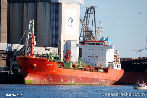
 MENTOR
Current Status
Where is the vessel?
MENTOR is currently in Near Dunkerque, based on AIS data received about 14h ago.
Latest AIS update:
Current position: 51.04618° N, 2.34987° E (Near Dunkerque)
Average speed (last 7 days): Loading…
Average speed (last 30 days): Loading…
Vessel profile: MENTOR is a Oil/Chemical Tanker with dimensions m x m.
This page combines live AIS, route history, probable destination signals, nearby traffic, and port activity for practical vessel monitoring.
The current position of vessel MENTOR is 51.04618 lat / 2.34987 lng. Updated: 2026-05-18 14:14:29 UTCNearest reference points:
- Near Dunkerque
- Near ARQUES
- Near Lombardsijde
Currently sailing under the flag of Antigua and Barbuda ![]()
Details:
Live Vessel MENTOR Analytics (details, animations, etc.)
Recent AIS points (UTC):
2026-05-18 10:44:30 UTC · 51.04608, 2.34988 · SOG 0 kn · COG 227°2026-05-18 11:52:41 UTC · 51.04605, 2.35002 · SOG 0 kn · COG -1°
2026-05-18 13:38:31 UTC · 51.04600, 2.35007 · SOG 0.1 kn · COG 228°
2026-05-18 14:14:29 UTC · 51.04618, 2.34987 · SOG 0 kn · COG 227°