 vesseltracker.com
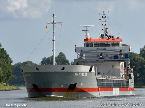
 Maasborg
Current Status
Where is the vessel?
Maasborg is currently in 11 nm W of Molengat, based on AIS data received about 1h ago.
Latest AIS update:
Current position: 53.00132° N, 4.35008° E (11 nm W of Molengat)
Average speed (last 7 days): Loading…
Average speed (last 30 days): Loading…
Vessel profile: Maasborg is a Multi Purpose Carrier with dimensions 110m x 14m.
This page combines live AIS, route history, probable destination signals, nearby traffic, and port activity for practical vessel monitoring.
The current position of vessel Maasborg is 53.00132 lat / 4.35008 lng. Updated: 2026-05-16 12:23:18 UTCNearest reference points:
- Near Molengat
- Near Den Helder
- Near Stolpen
Currently sailing under the flag of Netherlands ![]()
Maasborg built in 2005 year
Deadweight:
6000 tDetails:
Live Vessel Maasborg Analytics (details, animations, etc.)
Recent AIS points (UTC):
2026-05-16 07:24:12 UTC · 52.46126, 3.66843 · SOG 8 kn · COG 41°2026-05-16 09:27:20 UTC · 52.66167, 3.97500 · SOG 8 kn · COG -1°
2026-05-16 09:54:24 UTC · 52.70833, 4.04333 · SOG 8 kn · COG -1°
2026-05-16 12:23:18 UTC · 53.00132, 4.35008 · SOG 8.8 kn · COG 33°