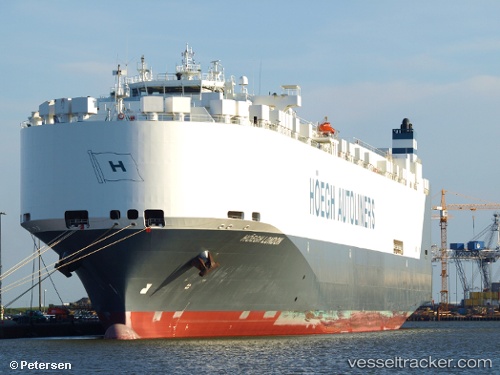
Hoegh London
Current StatusWhere is the vessel?
Hoegh London is currently in 14 nm NE of Dar es Salaam, based on AIS data received about 14h ago.
Latest AIS update:
Current position: 6.65300° S, 39.46568° E (14 nm NE of Dar es Salaam)
Average speed (last 7 days): Loading…
Average speed (last 30 days): Loading…
Vessel profile: Hoegh London is a Vehicles Carrier with dimensions 32m x 229m.
This page combines live AIS, route history, probable destination signals, nearby traffic, and port activity for practical vessel monitoring.
The current position of vessel Hoegh London is -6.65300 lat / 39.46568 lng. Updated: 2026-05-19 15:59:18 UTCNearest reference points:
- Near Dar Es Salaam
- 11 nm SE of Mombasa
Details:
Live Vessel Hoegh London Analytics (details, animations, etc.)
Recent AIS points (UTC):
2026-05-19 11:59:58 UTC · -6.44259, 39.78504 · SOG 13.3 kn · COG 191°2026-05-19 13:20:29 UTC · -6.63388, 39.54778 · SOG 13.3 kn · COG 233°
2026-05-19 14:23:58 UTC · -6.72481, 39.48392 · SOG 1.3 kn · COG 125°
2026-05-19 15:59:18 UTC · -6.65300, 39.46568 · SOG 3.3 kn · COG 80°